


II. The WISE All-Sky Data Products
1. General Properties of the All-Sky Data Release
The WISE All-Sky Data Release includes all the data taken from the time the
scan mirror rate was correctly set until the time that the outer hydrogen tank
that cooled the telescope ran out of hydrogen.
During this period all four
bands were operating in a very stable thermal environment.
During the whole mission WISE scanned
along lines
of constant ecliptic longitude from near one ecliptic pole to near the other
pole with a scan rate close to the orbital rate of 3.8 arc-minutes/second in
order to always point away from the Earth.
Each semi-circular track from ecliptic pole to ecliptic pole is called
a scan. During each scan
WISE took a frameset every 11
seconds. Each frameset contains
4 images, one for each band, with all bands observing the same 47 arc-minute
square patch of sky.
Images within each frameset were rejected and not included in the higher
level data products if they were streaky due to spacecraft acceleration
or if scattered Moon light was too strong, a problem that was worse at
long wavelengths.
The highest level data products are the:
- co-added Image Atlas, which has been match
filtered to maximize signal-to-noise, and
- a Catalog of over 563 million objects
with signal-to-noise ratio greater than 5 in at least one WISE band.
Also provided is a Reject Table of
objects that were detected on the image atlas tiles with signal-to-noise
greater than 3.5, but rejected from the Catalog
for reasons ranging from being a duplicated extraction in the Atlas Tile
overlap regions, for being an identified image artifact,
or for not reaching SNR 5 in any band.
The lower-level data products included in the release are the
Single-exposure images (Level 1b) and a
Database of all the object
detections on the single frames. This database is very useful for
variability studies.
The Single-exposure images and object detection database include frames that
were not used for making the higher level products, so all of the sky is
covered by data in this release.
- Range of Observation Dates Represented in the All-Sky Release:
- 2010 January 7 01:45:14 UTC to 2010 August 6 10:33:03 UTC
- Number of Scans and Single-Exposures Represented in the All-Sky Release:
- Scans: 6,331
- Single-Exposures:
- Total number acquired in all scans: 1,491,686
- Number of framesets used in Multiframe Processing after quality and dynamic filtering to construct the Image Atlas and Source Catalog (see V.2):
| W1 | 1,431,776 |
|---|
| W2 | 1,420,470 |
|---|
| W3 | 1,346,839 |
|---|
| W4 | 1,352,443 |
|---|
- Number of 1.564°x1.564° Atlas Tiles
Included in the All-Sky Release: 18,240
- Area Covered by the All-Sky Release:
- Nominal area covered by the All-Sky Release Products (see VI.2):
Table 1
| Product | W1 (deg2) | W2 (deg2) | W3 (deg2) | W4 (deg2) |
|---|
| Image Atlas | 41,248.19 | 41,247.52 | 41,234.13 | 41,242.08 |
| Source Catalog | 41,195.45 | 41,122.43 | 40,818.27 | 40,952.50 |
Single-Exposure Images and
Source Database | 41,252.96 | 41,252.96 | 41,252.96 | 41,252.96 |
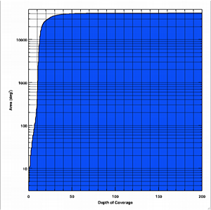
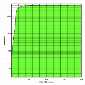
- Effective area covered as a function of Single-exposure depth-of-coverage in each band (see VI.2.b):
 |
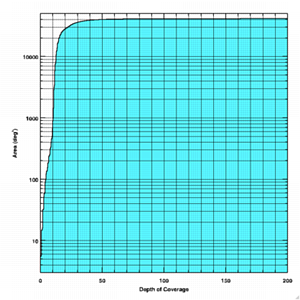 |
| Figure 1- W1 | Figure 2- W2 |
 |
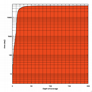 |
| Figure 3 - W3 | Figure 4 - W4 |
| Cumulative histograms showing the
effective area of the All-Sky Release Atlas as a function
of Single-exposure depth-of-coverage in each band. The All-Sky Release
Source Catalog selection criteria require five
or more coverages in at least one band.
|
- The effective area of the Source Catalog is further reduced because of the obscuring effects of bright stars (>VI.2.c.iii).
- All-Sky Maps
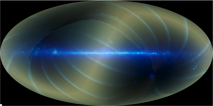 |
| Figure 5 - Aitoff galactic projection showing a 3-color composite mosaic of the 18,240 All-Sky Release Atlas Images. Galactic north is towards the top and galactic longitude increases to the left. Blue is W1, green is W2 and red is W3. |
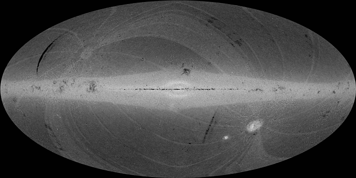 |
| Figure 6 - Hammer galactic projection showing a
grey-scale surface density map of All-Sky Release
Source Catalog
entries computed in 0.2°x0.2° spatial bins. The full range
is 0 to 1166 per bin (0 to 29,150 deg-2).
Galactic north is towards the top and galactic longitude increases
to the left. |
Last Updated: 2012 March 15


