
| Atlas Image Tiling Geometry | |
We present some examples of the sky tiling pattern expected for various Atlas Image (co-add) footprint sizes and pixel scales. The final sizes and scales are TBD.
A script "TileWISEsky" was written which takes as input a linear (square) tile size in pixels, a pixel scale, and a minimum linear overlap between any two adjacent tiles. It generates the RA, Dec and x, y, z coordinates of the tile centers, and optionally the coordinates of their corners. All tile position angles are zero. These tiles are represented as FITS images with an appropriate WCS and then mosaicked. The resulting depth-of-coverage maps are shown below. The tiles are optimally arranged in separate iso-declination bands. The nominal input minimum overlap is tweaked at each declination band to obtain a uniform distribution of tile spacings.
The most interesting tiling patterns occur at the poles (Sections 2 - 5 below). Section 6 shows an example on the equator. The text summaries below are outputs from the "TileWISEsky" script. The storage sizes refer to uncompressed data volumes and account for three image products per WISE band: an intensity, uncertainty and coverage-depth image. With four bands, this gives 12 image products per tile.
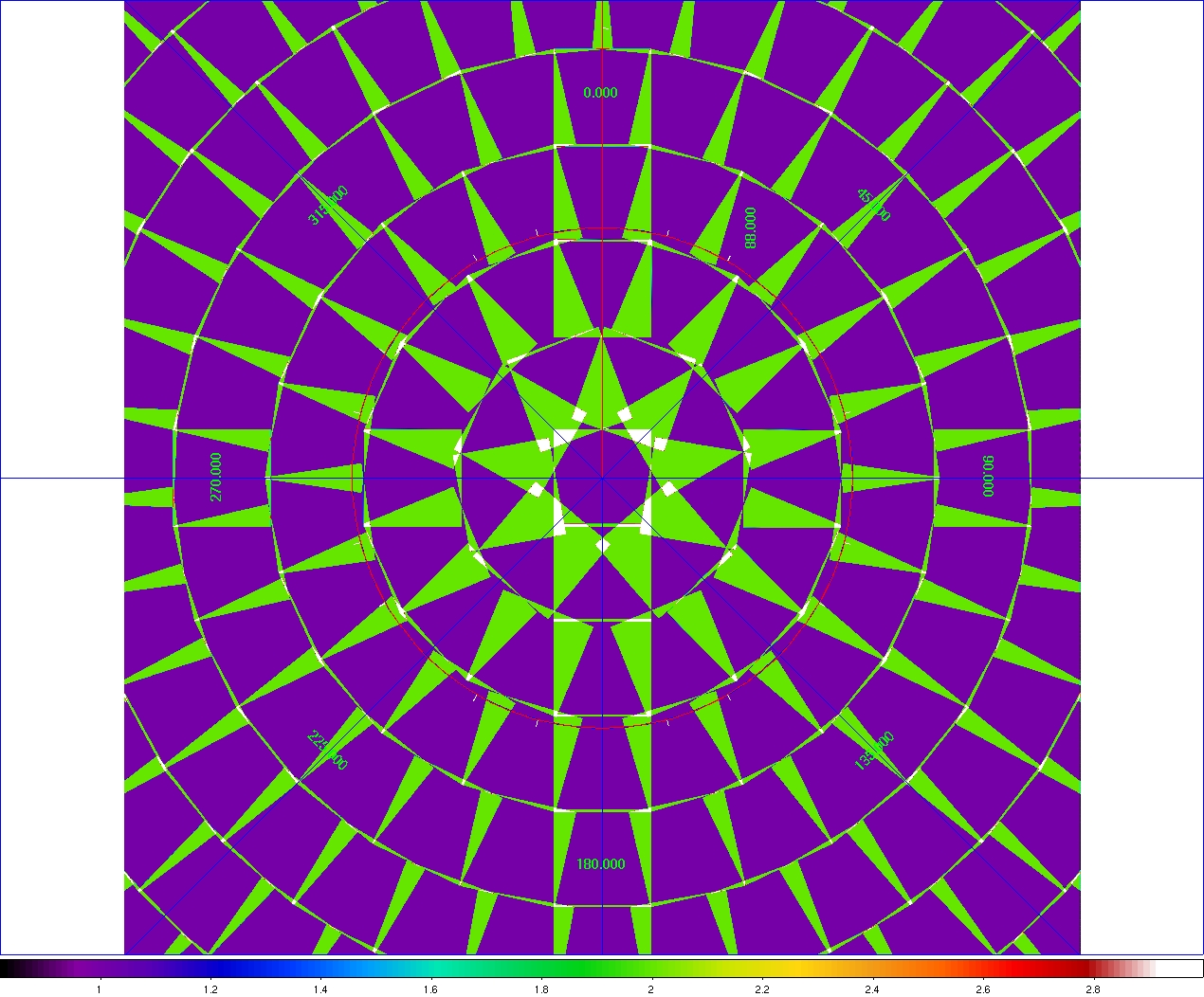
 Number of tiles (footprints) on sky = 137341
 Number of iso-declination bands = 327
 Required storage assuming 4 Byte/pixel, 12 products/tile = 27.65 TB
 Input pixel size = 1.000000 arcsec/pixel
 Input linear tile size = 2048 pixels = 0.568889 deg
 Input linear minimum tile overlap = 70.000000 arcsec
 Center WCS and x,y,z coordinates written to: Tiles2048p1.txt
 |
| Figure 1 - Mosaic of WISE Atlas Image tiles inside a declination band of ~|86.8°| (=5th band from the center). This mosaic can be downloaded in FITS format here. Click on image to enlarge. |
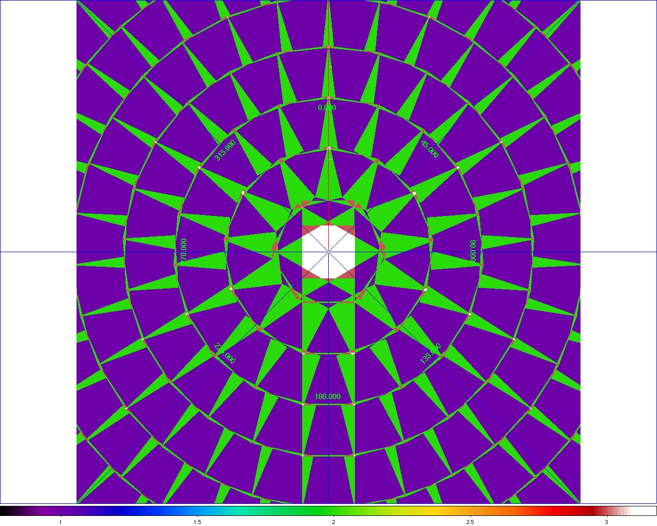
 Number of tiles (footprints) on sky = 71374
 Number of iso-declination bands = 235
 Required storage assuming 4 Byte/pixel, 12 products/tile = 14.37 TB
 Input pixel size = 1.375000 arcsec/pixel
 Input linear tile size = 2048 pixels = 0.782222 deg
 Input linear minimum tile overlap = 70.000000 arcsec
 Center WCS and x,y,z coordinates written to: Tiles2048p1.375.txt
 |
| Figure 2 - Mosaic of WISE Atlas Image tiles inside a declination band of ~|86.2°| (=5th band from the center). This mosaic can be downloaded in FITS format here. Click on image to enlarge. |
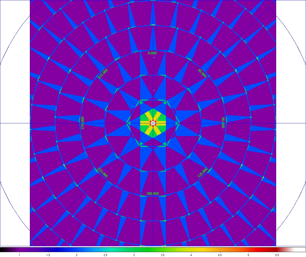
 Number of tiles (footprints) on sky = 34162
 Number of iso-declination bands = 163
 Required storage assuming 4 Byte/pixel, 12 products/tile = 27.51 TB
 Input pixel size = 1.000000 arcsec/pixel
 Input linear tile size = 4096 pixels = 1.137778 deg
 Input linear minimum tile overlap = 120.000000 arcsec
 Center WCS and x,y,z coordinates written to: Tiles4096p1.txt
 |
| Figure 3 - Mosaic of WISE Atlas Image tiles inside a declination band of ~|84.4°| (=5th band from the center). This mosaic can be downloaded in FITS format here. Click on image to enlarge. |
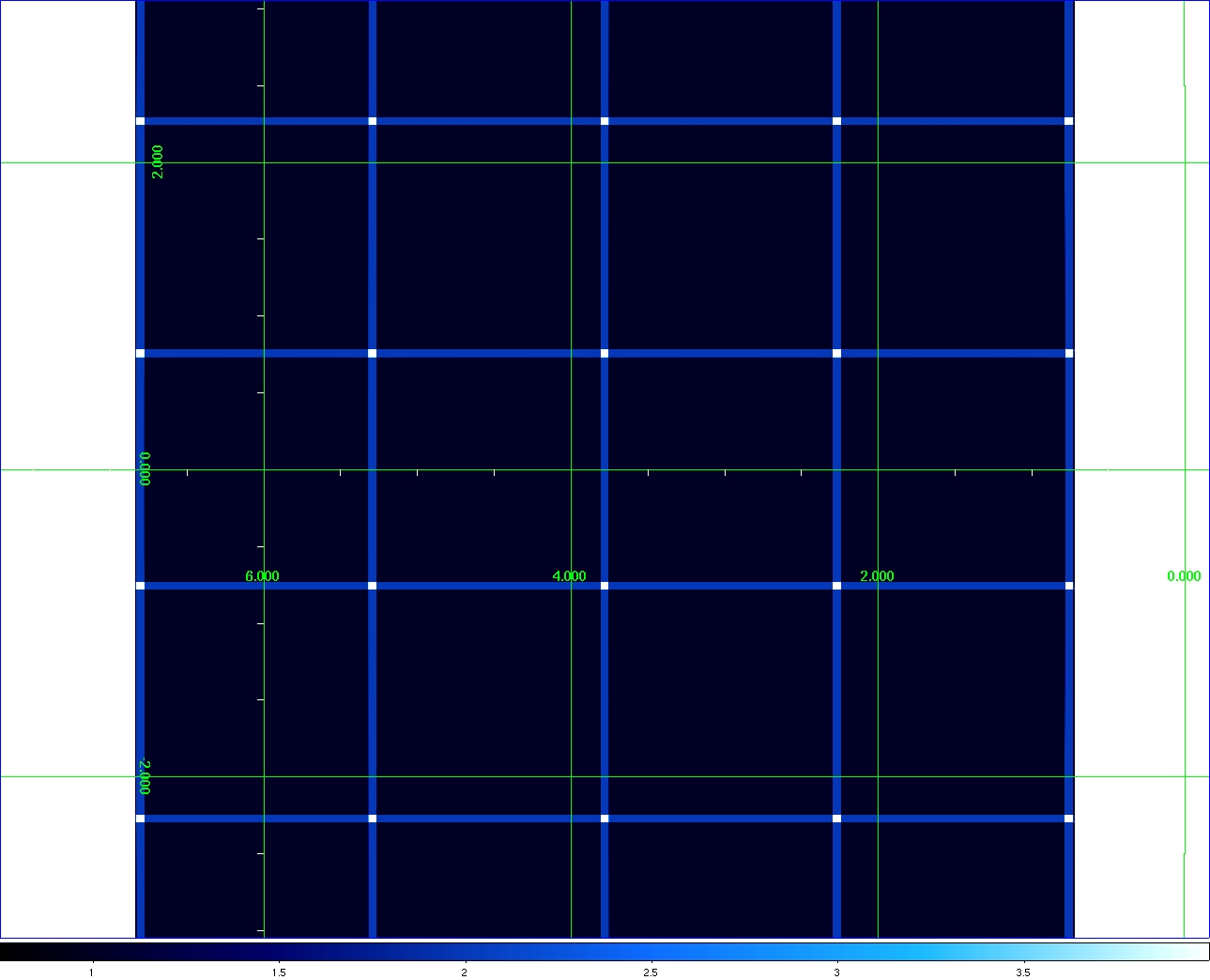
 Number of tiles (footprints) on sky = 18241
 Number of iso-declination bands = 119
 Required storage assuming 4 Byte/pixel, 12 products/tile = 14.69 TB
 Input pixel size = 1.375000 arcsec/pixel
 Input linear tile size = 4096 pixels = 1.564444 deg
 Input linear minimum tile overlap = 180.000000 arcsec
 Center WCS and x,y,z coordinates written to: Tiles4096p1.375.txt
 |
| Figure 4 - Mosaic of WISE Atlas Image tiles inside a declination band of ~|82.4°| (=5th band from the center). This mosaic can be downloaded in FITS format here. Click on image to enlarge. |
 Number of tiles (footprints) on sky = 18241
 Number of iso-declination bands = 119
 Required storage assuming 4 Byte/pixel, 12 products/tile = 14.69 TB
 Input pixel size = 1.375000 arcsec/pixel
 Input linear tile size = 4096 pixels = 1.564444 deg
 Input linear minimum tile overlap = 180.000000 arcsec
 Center WCS and x,y,z coordinates written to: Tiles4096p1.375.txt
 |
| Figure 5 - Mosaic of WISE Atlas Image tiles using same sizes/scales as in Figure 4 but on the equator. Mosaic spans ~ 6° × 6°. This can be downloaded in FITS format here. Click on image to enlarge. |